Matt Bishop and Steve Cooper grabbed exposed roots and mossy rocks for balance as they climbed up a steep hillside. It was just after 7 a.m. on Sept. 10, 2022, and the two friends were headed up Baring Mountain, on the edge of the Wild Sky Wilderness in Washington’s Cascade Range. Silver firs, cedars and hemlocks encroached on the unmaintained trail, and although the sun was still low in the sky, the morning was hot and sweat clung to the back of their necks.
Bishop, an engineering manager for an aerospace company, and Cooper, a commercial electrician, had met five years earlier and started hiking together almost every weekend during the height of the pandemic. They shared a love of solitude and summits that made them excellent companions, in sync on where and how they wanted to explore. Cooper created a YouTube channel, The Path Least Taken, to document their adventures, including the Baring Mountain trek.
The men chatted and took turns filming each other as they picked their way through brush and lime-green ferns, gaining almost 2,000 vertical feet in less than half a mile. “Keeps you on your edge, that’s for sure,” Cooper says to Bishop in one clip. Mountain views unfurled on both sides of the ridgeline, overlooking the ancestral homelands of Indigenous people from the Tulalip, Stillaguamish, Snoqualmie and other tribes, where some still harvest huckleberries and cedar today. Far below, beyond the trees, the South Fork of the Skykomish River meandered in a silver-blue ribbon. The trail funneled Bishop and Cooper into a boulder-filled gully. They glimpsed blue sky as they scrambled up the rocky chasm and started their final push to the summit.
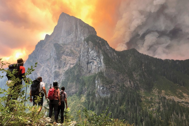
The view from the next outcrop brought them to a halt. At the trailhead that morning, they’d noticed some smoke, but thought it was acrid haze from fires in eastern Washington — not a big deal, as long as they could breathe easily. But now it was more than haze: Deep orange flames and dark gray plumes of smoke blocked the sky. This was a new fire, three peaks down the ridgeline — and headed their way.
Bishop pulled out his phone and saw a text from his wife of 23 years, Sonia. She’d noticed smoke while setting up a church classroom 40 miles away in Snohomish and texted to ask if he was all right. Bishop sent her photos of the mountains, surrounded by smoke and flames, and a message: “love you.” “That looks too close,” she replied.
Bishop suggested turning back and Cooper, on video, agreed. “Yeah, we’re going to turn around,” he said. “I don’t want to risk it.” His voice trailed off. “It’s going to blow up,” Cooper added. “I see the flames.”
“It’s pretty big,” Bishop agreed off-camera, his voice muffled by high winds that had set the evergreens around them dancing, their branches swaying. Bishop texted Sonia: They were getting out. The hikers hurried back down the gully they’d just ascended.
“We’re going to turn around. I don’t want to risk it.
It’s going to blow up. I see the flames.”
The view of the Bolt Creek Fire from Baring Mountain.
But the blaze had other plans. Halfway down the chute, Bishop and Cooper watched in horror as the fire, hungry for fuel, snaked its way around the backside of the ridge and emerged in front of them. Flames engulfed the trail below the gully, consuming their escape route, roaring like a jet engine preparing for takeoff. “Oh fuck,” Cooper said. “That came fast, dude.” “Hopefully you guys get to see this video,” Bishop added, brow furrowed. “Otherwise, we didn’t make it.” He sent another message to his wife: “We’re trapped.”
Their breathing short and shallow, they considered their only option: Scramble back up the scree they’d just descended to huddle below Baring Mountain’s jagged peak, the rocky, open space a potential refuge — or a dead end.
SEVEN HOURS EARLIER and seven miles away, Katijo Maher had awakened to the sound of her basset hound, Frida Hansdottier, throwing up. When she rushed the dog outside, she saw a fiery glow on the hills above town. “That’s not the sun,” she thought.
Maher, a former firefighter and visitor information specialist at the Skykomish Ranger District, knows how fast fires can move. The National Weather Service had predicted high fire danger that weekend; the region was in the midst of a record-breaking dry summer, with only half an inch of rain in nearby Seattle all season. The Mount Baker-Snoqualmie National Forest had just raised its fire danger rating to “very high,” noting in a press release that high winds, low humidity and hot temperatures had turned the forest “into a virtual tinderbox.”
Fires on the wetter, cooler west side of the Cascades, where the hikers were, have historically been rare. But they’ve become more common in the last two decades, and the Pacific Northwest is experiencing longer fire seasons. More acres burned over two weeks in 2020 than in the last five decades. Wildfires across the United States are fueled by hotter, drier conditions caused by climate change and decades of federal fire suppression policies — including the stifling of Indigenous burning practices — that created a fuel buildup. While low-intensity wildfires are part of a healthy forest, blazes that burn everything to a crisp can do more harm than good.
According to Maher’s boss, Skykomish District Ranger Joe Neal, the national forest and private timberlands around Baring Mountain are on an every 200- to 300-year fire cycle — and the last recorded major blaze occurred sometime in the 1700s. They were overdue.
Maher called the forest’s fire management officer, triggering the mobilization of local, state and federal firefighting resources. The blaze had begun on private timberlands, which fall under the Washington Department of Natural Resources’ (DNR) jurisdiction, but it quickly crossed into neighboring national forest. By 6:30 a.m., the Forest Service had requested as many firefighting resources from the DNR as possible. The Bolt Creek Fire, as it was dubbed, quickly grew in size and severity as 100-foot-high flames licked dry tree branches and gobbled leftover logging debris.
As locals evacuating the community of Grotto fled west, firefighters and emergency responders headed east. The Skykomish Fire Department, fighting to keep the fire from the town, needed reinforcements. DNR Incident Commander Gene Phillips sped down Highway 2 to establish a joint command post at the Skykomish Ranger Station. Chunks of ash and flaming embers hit the windshield of his truck. “This fire was going big,” he said. “It was romping.”
Not yet aware of the backcountry hikers, Snohomish County Search and Rescue launched a reconnaissance flight over the area, where hundreds of people a day visit a popular lake. Pilot Bill Quistorf guided his helicopter closer to the blaze, but the ride grew choppy — airspace around wildfires can be incredibly turbulent due to rising hot air. “I’ve been flying for 50 years,” Quistorf said. “That was the worst turbulence I’ve ever flown in.” The rough air forced him to turn around; he later learned he’d been just half a mile away from Bishop and Cooper.
Wind, smoke and jagged terrain complicated aerial firefighting all morning. The air tankers that drop water and fire retardant couldn’t fly safely in the narrow river canyon along the fire’s southern edge, and the way the smoke draped over the landscape made it dangerous for helicopters, too. The few retardant drops pilots did manage failed. “The fire just blew right over,” Phillips said. “(The retardant) really didn’t even slow it down.”
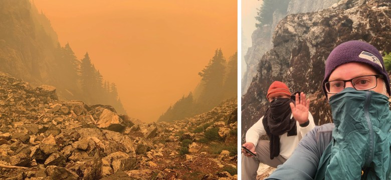
ON THE ROCKY SLOPE below Baring Mountain’s peak, just before noon, Bishop and Cooper found a pocket of cell service. It was about 30 minutes after they first saw flames. Cooper called his partner, Ed, on his cellphone and then used his emergency palm-sized satellite phone to send an SOS notification with their coordinates to an emergency response coordination center. He also called 911. “We have fire all around us and we can’t get out,” Cooper told a dispatcher. The operator said they’d inform search and rescue crews, who’d call back. The men took a selfie while they waited. In the photograph, their noses and mouths are covered by long-sleeved T-shirts, dampened with water from their packs, to block the smoke funneling up the gully they were crouched in. Cooper raises his hand in a wave; Bishop stares straight into the camera. Bishop texted the image to Sonia, then powered down his phone to save the battery.
Within half an hour, a dirty orange glow obscured everything around them. When Cooper’s cellphone finally rang, a sheriff’s deputy asked if the men could get to water, but they could not. Seattle Mountain Rescue volunteers, part of King County Search and Rescue, arrived in the area before realizing it wasn’t safe to go after the hikers. And the next call brought worse, but unsurprising, news: No helicopter could reach them. They were on their own, surrounded by fire.
Bishop and Cooper weighed their options. Would they die if they stayed where they were and waited for the fire to pass? With no trail to follow, would they die if they left? They pored over maps on a GPS app on Bishop’s phone, searching for an escape route. They debated running through still-smoldering terrain, but decided against it. Then they spotted something: a route that might get them down the mountain, around steep cliffs and drop-offs. Bishop and Cooper would try to rescue themselves.
IN SNOHOMISH, SONIA DROVE HOME from church, crying. At home, she huddled with friends, her teenage son, Kaleb, and their chocolate Lab, Koda. Kaleb’s birthday party was that afternoon; he’d turn 15 the next day. Mason, their older son, would graduate from U.S. Army Basic Combat Training next month. Sonia wondered if her husband would live to see these milestones. She clung to the only information she had: a dot representing Bishop and Cooper’s location, transmitted by the satellite phone they carried, information that Ed shared with her. The circle moved sporadically on the digital map, indicating the hikers could still be alive.
But their chances of survival looked slim. “It was a pretty bad feeling to know that I had exhausted every tool in my limited toolbox,” Peter Teske, the on-call Snohomish County Search and Rescue coordinator, said about that day. “I was already planning on us having to go collect their bodies after they perished and the fire had moved on.”
That morning, the gravel road to the trailhead was open, a few other cars in the lot. The skies were only tinged with smoke, which can travel hundreds, even thousands, of miles from a blaze. Looming mountains blocked the burgeoning Bolt Creek Fire from the hikers’ sight. “I wouldn’t say it was their fault,” Phillips, the joint incident commander, said. “They were in the wrong place at the wrong time.” Would-be rescuers agreed. “I don’t fault those guys at all,” Teske said. “There was zero indication that there was a new fire.”
And the men had done a lot of things right. They’re the kind of hikers who bring extra trekking poles to give to strangers with sprained ankles. They knew how to read maps, were fit enough for off-trail travel, and carried that emergency satellite phone. Bishop, who volunteered on a search and rescue team as a young adult, and Cooper, a retired member of the Navy, were poised under pressure. They kept calm.
“It was a pretty bad feeling to know that I had exhausted every tool in my limited toolbox.”
There wasn’t much more they could have done, Snohomish County Search and Rescue members said. And, given the changing climate and increasingly severe wildfires, Search and Rescue wasn’t sure what else their own crew could have done, either. “I’m trying to think of a way that we could better prepare for that eventuality, and I cannot,” Sgt. Greg Sanders said. Search and rescue units won’t risk the lives of their members, many of whom are volunteers, to pluck people from a wall of flames. “We will never, ever, ever — you can underscore that ever — knowingly send them into harm’s way,” Teske said.
So what does hiking in the age of fast-moving, unpredictable fires look like? Another hiker in the area that day has ideas. “Just as we add avalanche danger to trip planning during the winter, we must add wildfire danger planning during the dry months,” Alison Dempsey-Hall said. She’d noticed a lone car in the trailhead parking lot as her group fled — Bishop’s Jeep. In the future, she plans to check the National Weather Service for red flag warnings, issued when high temperatures, high winds and low humidity mean that wildfires can start easily and spread quickly. “If you’re to be really cautious, you’d probably see that red flag warning and say, ‘Hmm, I’m going to choose another route,’” she said.
A more expansive definition of recreation won’t shield hikers from wildfires. But it may help better situate them in their surroundings. The Snoqualmie Tribe’s Ancestral Lands Movement, for example, encourages people to protect, respect and restore the places they visit. “We’re losing that sense of reciprocity and restoration,” said Jaime Martin, the tribe’s executive director of governmental affairs and special projects. “We need to start rethinking and reframing what recreation looks like, and bringing people into some of those activities that make landscapes more resilient.” That could look like getting involved in local restoration projects, before or after wildfires sweep through.
BACK ON THE MOUNTAIN, Bishop and Cooper began moving downhill around 1 p.m., still surrounded by burning trees and smoke. The wind whipped up, pushing the fire back toward them. Flames crackled up the trees beside the gully, trying to eat them from below. So they changed directions, looking for a different route away from the danger.
They followed a dry creek bed, shinnying down ledges and walls, some of them taller than they were. But a soaring 200-foot-high cliff stopped their progress. More trees ignited and toppled, hitting the ground above them, dislodging boulders that thundered downslope.
Another pocket of cell reception dangled the possibility of rescue. The King County Sheriff’s Office told them that a helicopter could reach them, if they could get to an open spot. But the hikers’ location — on the border of two counties — created complications when their next call was routed to a dispatcher in Snohomish County. “I’d like to stay and talk with you, but the fire’s coming down. I’ve gotta jam,” Cooper said, his voice clipped and tense. The dispatcher asked him to wait for a supervisor, but he hung up. Eyes watering from the smoke, he and Bishop climbed back up the creek bed and continued to look for another way out.
More ledges blocked their way. The ground was covered with slippery dry pine needles, and they grabbed at brush to stay upright. Suddenly, Bishop lost his footing and began sliding toward the edge of yet another cliff. Cooper watched helplessly as his friend grabbed at a tree to stop his fall. It worked. With the crackle and pop of fire above them, they took a moment to breathe, and then kept moving. When they encountered more ledges, they used each other’s shoulders and hands to create steps on the steep drop-offs.
A chute, scrubbed clean of trees but thick with thorny bushes, provided a new route to the valley below. Cooper narrated their progress to the camera; Bishop, exhausted, simply waved. Ahead, a flat area with few trees looked promising. They bushwhacked down, edging farther and farther from the flames. Every foot down in elevation brought them a step closer to gentler terrain and a path to safety.
Finally, they stumbled on a well-maintained trail among emerald foliage untouched by fire. They paused for a moment and hugged. Their throats were raw from hours in smoke without water, and they talked about their cravings — Diet Coke, water, Gatorade. They followed the trail to the parking lot, got in the Jeep and sped off, light gray smoke settling into the trees above them.
IN THE SMALL TOWN OF BARING, the tired, thirsty hikers pulled into a gas station. Residents were evacuating, and a driver with suitcases piled in the bed of his truck struck up conversation. “I think there are still hikers stranded there,” he said, gesturing at the mountains. “Nope,” Bishop said. “That’s us.” By 6 p.m., they were back at Bishop’s home, eating gyros with Sonia and Kaleb, who teased his dad about missing his birthday party that afternoon. That night, at his own home, Cooper struggled to sleep. Adrenaline still coursed through his body.
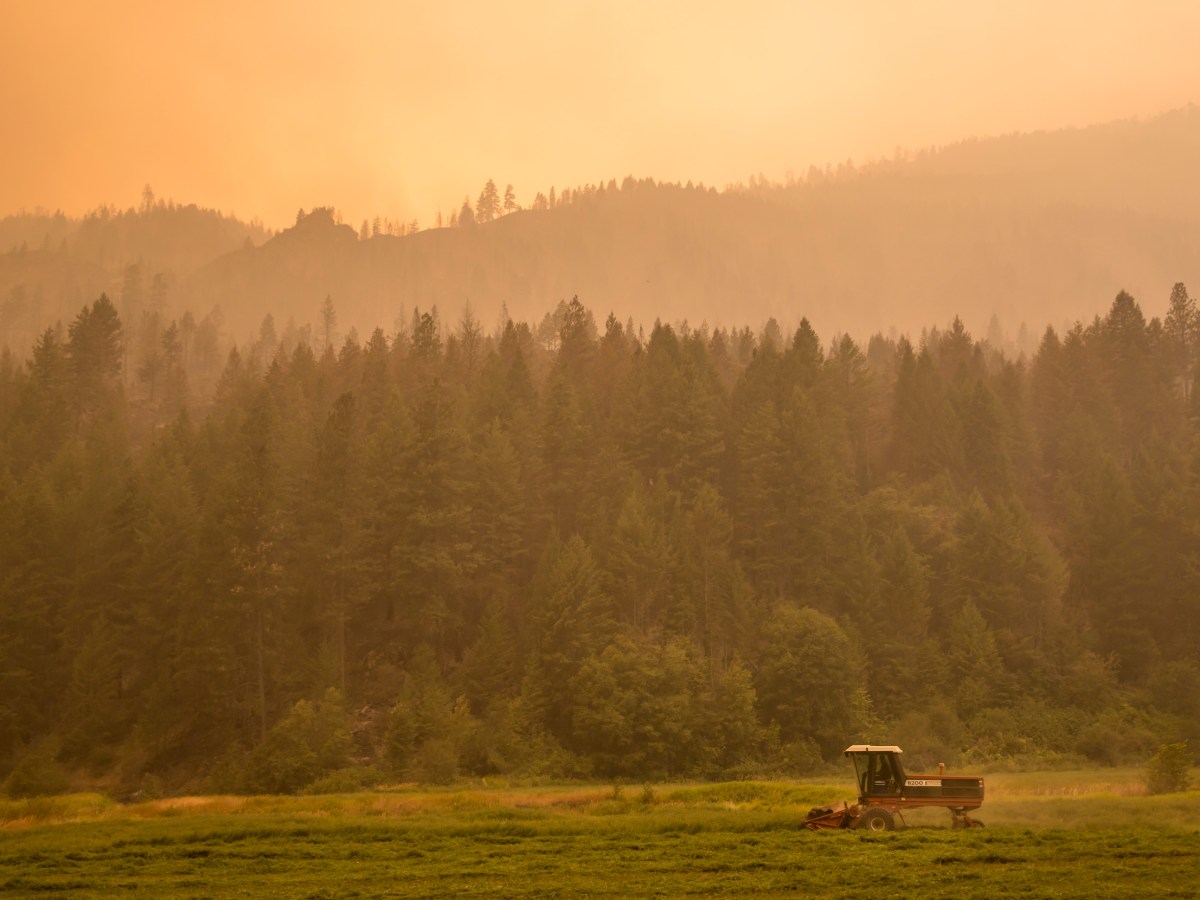
Meanwhile, the Bolt Creek Fire kept burning. It continued to race west; by nightfall, evacuation orders covered 500 homes, and the blaze had grown to 7,000 acres. “The fire never slowed down,” Phillips, the joint incident commander, said. Over the next few days, over 430 firefighting personnel streamed into the area. In the coming weeks, smoke from the Bolt Creek and other fires in the Cascades blanketed the greater Puget Sound area, including Seattle and King County.
Wildfire smoke, a mix of gases and fine particles, is dangerous, potentially deadly, to people who breathe it in, even if they are nowhere near the fire itself. Recent assessments estimate that wildfire smoke causes between 6,300 and 32,000 deaths in the U.S. annually, a number that varies according to study methodology and time frame. Children, the elderly, and people who are pregnant or have pre-existing lung and heart conditions are especially vulnerable, while those who work outside, such as farmworkers, or live in housing that lets smoke in — often people of color — are more likely to be exposed.
Two in five Seattle residents are low-income, and at least 13,000 people in King County are unhoused at any given time. Resources like smoke centers, where people can escape the poor air, and homemade air filtration systems are “short-term Band-Aid solutions,” said Anjum Hajat, an epidemiology professor at the University of Washington. More permanent fixes, like adequate legal protections for workers who toil in the smoke and air purification for all homes, are still needed, said Hajat — and, of course, tackling the climate crisis by burning fewer fossil fuels. In the meantime, many people are forced to inhale smoke for as long as it lingers. “Disasters only exacerbate existing social inequalities that we see in society,” said Michael Méndez, a professor who studies environmental policy and planning at the University of California-Irvine.
On Oct. 20, smoke from the Bolt Creek Fire and other blazes gave Seattle the worst air quality in the world. Why don’t they just put out the fire? some wondered. But the steep, inaccessible terrain where it was burning made firefighting challenging, and there are ecological benefits to letting a fire like this burn; for one thing, it reduces the chance of future, more severe fires. The blaze ultimately burned over 15,000 acres, including almost all of a 960-acre tract of timberland that the Tulalip Tribes reacquired in 2019 to protect and provide reliable access to culturally important species. But only one outbuilding was destroyed, and no one died. Rain and snow finally dampened the fire in late October. As of early July, officials had determined that the fire was human-caused, but the details were under investigation.
Hoping to educate others, Cooper published videos about the hike on YouTube. They have been viewed nearly 200,000 times; most of the comments are supportive, including posts from local search and rescue crew members, hikers and residents. Some of them learned the hikers survived only when they saw the video.
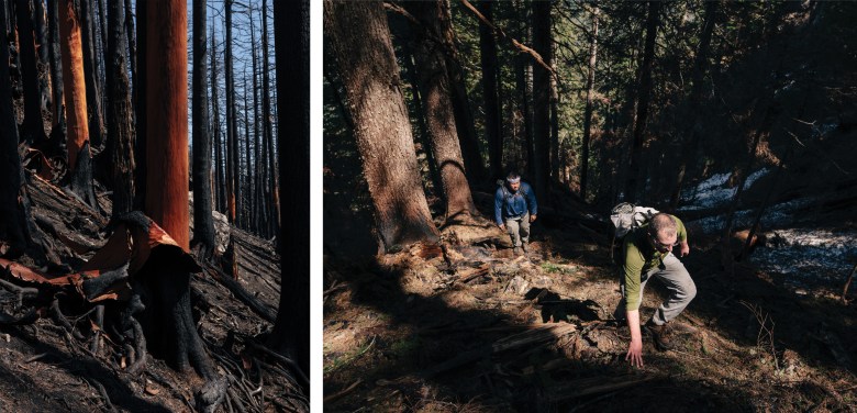
LIKE A SCAR ON THE HUMAN BODY, marking where the skin is healing after an injury, a fire’s burn scar tells a tale of destruction and recovery. A charred landscape of blackened soil eventually blossoms with new plant life. But for those who survive them, fires can leave invisible scars, too.
In the weeks following the Bolt Creek Fire, Bishop and Cooper encountered other people’s campfires on backpacking trips. The sound of dry wood crackling and the smell of smoke upset Bishop: “One little spark, and this whole place goes up,” he said. “It will be a long time before I build a fire in the woods, if ever. I don’t think the benefit is worth the risk.” Cooper described feeling disconnected from his body; he had to get back outside for things to feel real again.
“It will be a long time before I build a fire in the woods, if ever. I don’t think the benefit is worth the risk.”
Smoke and wind gusts are common triggers for other wildfire survivors. “When you haven’t fully processed the trauma, anything that comes up that’s related to what you went through is going to retrigger, and put them right back into the moment the initial trauma happened,” said Darla Gale, a therapist who works with wildfire survivors in California. Some of her patients report difficulty sleeping and nightmares, as well as feelings of anger and guilt. Survivors also experience anxiety and depression, though therapy can help. Chronic mental health issues tend to appear six months post-fire. A 2021 study found that fire survivors suffered post-traumatic stress disorder three times more often than the general population.
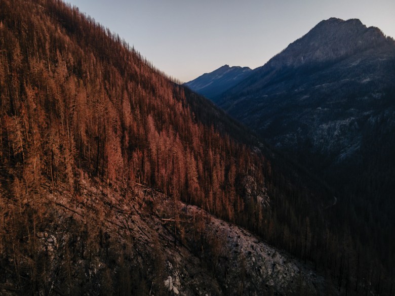
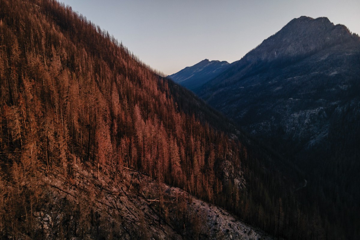
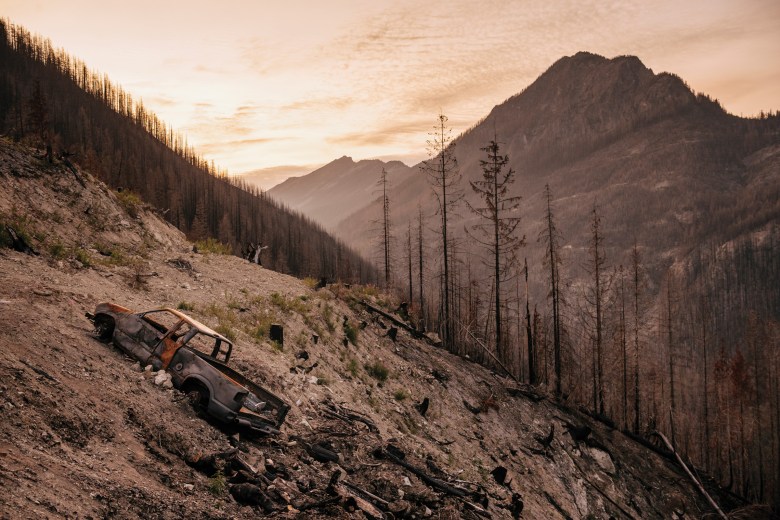
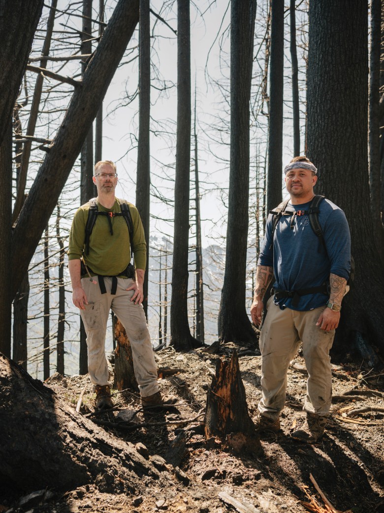
A VERDANT FOREST surrounded Bishop and Cooper when they hiked Baring Mountain last September. But nothing was the same when they returned to the ridgeline in May. There was no shade from formerly lush stands of evergreens and the sun’s hot rays beamed through toothpick tree trunks. Flames had peeled back bark, revealing smooth innards the color of papaya. A lone chipmunk scurried in the dust. Ashy mud slid underfoot and loose pebbles, once hidden beneath the soft forest floor, crunched under their boots. In the distance, a sooty grouse droned its low hooting call. Bishop absorbed his scorched surroundings. “If we had been headed down a half hour earlier, we would’ve been dead,” he said. “If we got caught in these woods, there’s no way we would have been able to get out.”
The men remain cautious. To avoid hiking in areas with limited escape routes later in the summer, when fire danger is greater, Bishop and Cooper hope to hike a section of the Pacific Crest Trail in early August. Recreation patterns are expected to shift in time and location as wildfires and other effects of climate change continue to alter the landscape. “You have no choice but to adapt,” said Emily Wilkins, a social scientist who studies recreation and climate change for the U.S. Geological Survey in Colorado. Research in the Columbia River Gorge following the 2017 Eagle Creek Fire showed that people avoided the entire area in the year following the fire. Smoke and wildfire closures may force hikers to seek out new areas; in the Pacific Northwest, the cooler, wetter places on the coast may see a rise in visitors as a result.
Today, the once-arduous trail to crest the ridgeline to Baring Mountain is nearly impassible. Trees toppled like jackstraws form a tangled maze. Bishop, wearing the same khaki hiking pants as last year, and Cooper, carrying the same black-and-white backpack, picked their way through debris to peer at the cliffs they’d scrambled down last September. “Looking at it now, I’m not sure how we did that,” Cooper said. They recalled other trips they’ve taken since and shared comfortable silences. Whenever they touched a stump or a rock for balance, their hands came away blackened with soot.
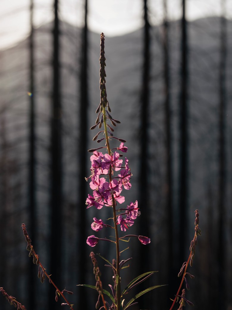
The changed landscape could have a profound impact on the communities nestled below. Wildfires lessen soil’s ability to absorb water, so bursts of precipitation can be dangerous. Thunderstorms, rapid snowmelt, atmospheric rivers or rain falling on snow can trigger debris flows: earthen rivers carrying boulders and missile-like trees that can hurt and kill people, destroy homes, block roads and cause flooding. For months after the fire, fallen trees, uprooted in loose soil, caused periodic highway closures, cutting off Skykomish residents from the closest grocery stores and doctors’ offices. USGS modeling indicates that entire swaths of the mountains above the Grotto community have a high probability of sliding; residents could be at risk for the next seven years or more.
Outside Skykomish, a dirt road winds up a hillside into the mountains. Black stumps pockmark the slopes, and the wind whips dust in circles. Signs that this was once a popular hangout spot — charred metal cans and broken glass — sparkle in the sun. Fireweed and chartreuse ferns stubbornly shoot out of the ground, early markers of regeneration and regrowth. This is where the Bolt Creek Fire originated, the result of human carelessness and a parched forest, ready to burn. As Bishop and Cooper continue to grapple with how they can stay safe hiking in a wildfire-prone future, locals in the Skykomish River Valley warily eye the burned mountainsides above them and wonder what the next fire season will bring. “Anytime we get an east wind,” said Maher, the ranger district employee who called in the Bolt Creek Fire, “we’re on pins and needles.”
Note: This story was updated to correct that Bill Quistorf was flying a plane near the wildfire. It was a helicopter.
Editor’s note: Photos from the day of the fire are courtesy of Steve Cooper and Matt Bishop.
Kylie Mohr is a correspondent covering wildfire for High Country News. She writes from Montana. Email her at kylie.mohr@hcn.org or submit a letter to the editor. See our letters to the editor policy.
This article appeared in the print edition of the magazine with the headline Chased by Flames.

