
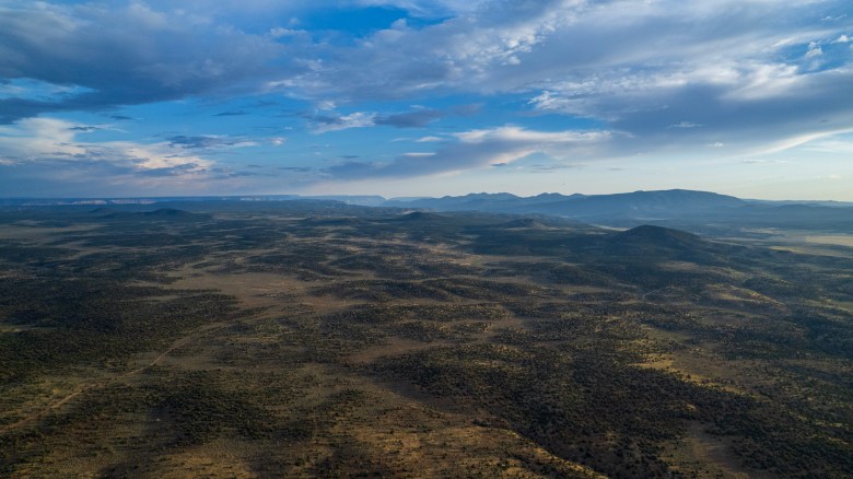
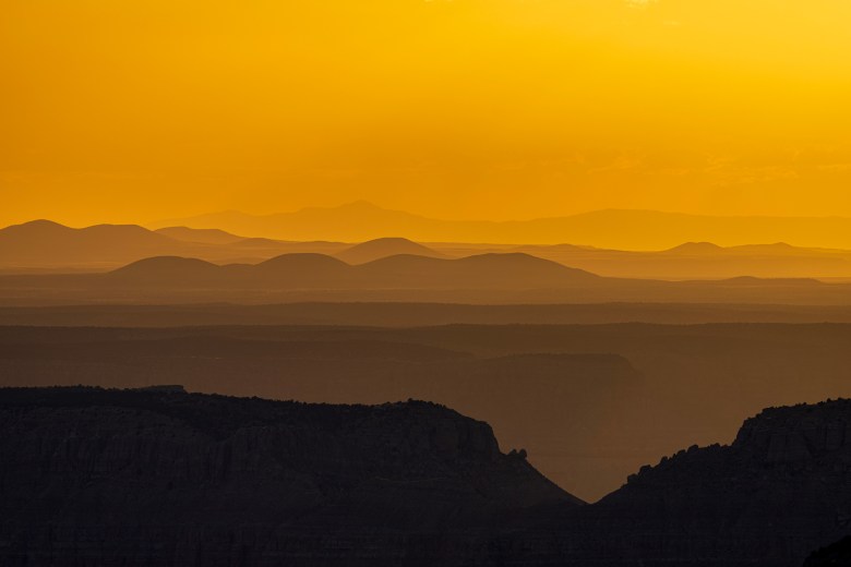
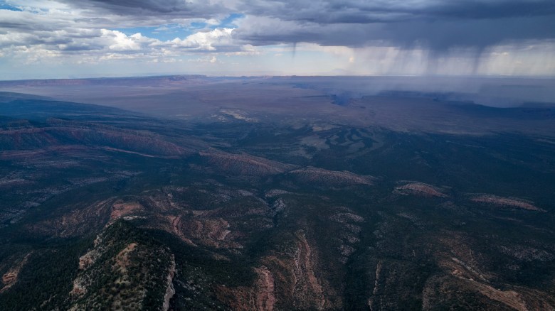
The newly designated Baaj Nwaavjo I’tah Kukveni-Grand Canyon National Monument encompasses a swath of incredible landscapes: 1 million acres of Bureau of Land Management and U.S. Forest Service lands. In many respects, though, its natural beauty hides in the shadow of the more famous Grand Canyon.
I decided to document the region, along with fellow Diné photographer Mylo Fowler and writer Jonnah Perkins. We spent nearly a week in the area, just two weeks before the designation, heading south from Kanab, Utah, to the new monument’s northwestern region. We passed through the expansive sagebrush steppe that borders the Kanab Creek Wilderness Area on its eastern side and Grand Canyon National Park on its southern end. Within an hour of leaving the highway, we encountered 15 pronghorn, just the first of the many herds we would see that day.
As I zigzagged the van down the washboard dirt road, we chatted about the history of national monuments and what this one would mean for this region. I kept laughing, imagining how Teddy Roosevelt and the writers of the Antiquities Act, which created national monuments, would probably seethe with frustration if they found out that tribes were leveraging this law to protect their ancestral homelands. I only wish that someone could tell them.

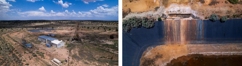
We headed south toward the two idled uranium mines on the North Rim of the Grand Canyon. I suspect that these mines’ remoteness has kept them out of the public eye. I hope that showing where they are and what they look like will help give further credence to the need to protect the area. The mines sit right above the drainage into Hack Canyon, which feeds into Kanab Creek, and then into the Grand Canyon. Any discharge from them could eventually end up in the waters of the Colorado River, which 40 million Americans depend upon.
My own connection to uranium mining is deeply personal. My grandfather was among the many young Navajo men who worked in the uranium mines on the Navajo Nation during the Cold War. A defining feature of this history was the mining companies’ blatant disregard for worker safety and environmental safeguards. When the price of uranium ore collapsed at the end of the Cold War, the companies abandoned thousands of mines, leaving tailings piles that continue to contaminate the soil and water. This history is not forgotten by the tribes in the area.
A defining feature of this history was the mining companies’ blatant disregard for worker safety and environmental safeguards.
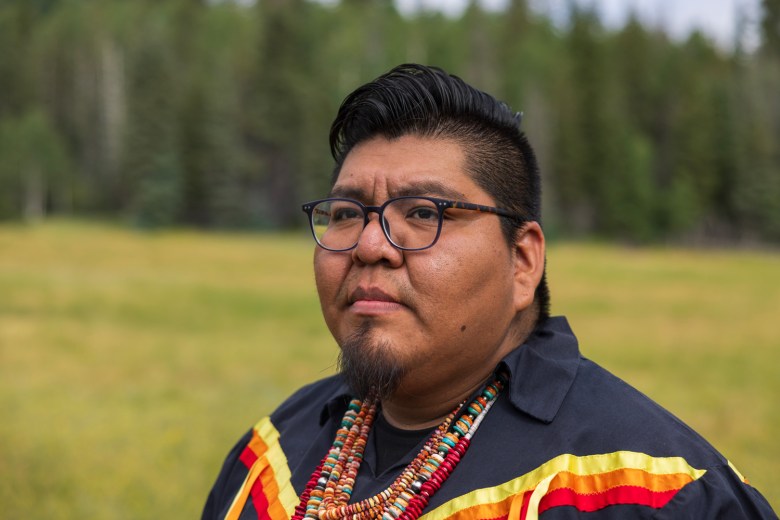
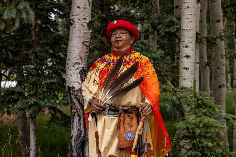
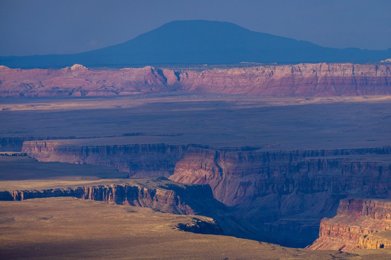
The Kaibab Plateau, a broad uplift rising to over 9,000 feet, covered with pines, aspen and a multitude of natural springs, splits the North Rim of the Grand Canyon. The next day, we met there with Stuart Chavez and Diana Sue White Dove Uqualla, former and current tribal council members for the Havasupai Tribe. They described the importance of the region to the local tribes, but made it clear that protecting it serves all the people downstream, as well as the wildlife that call this place home, and the water itself.
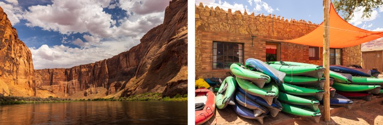
The following day we ventured toward Marble Canyon and the parcel of BLM land near the Colorado River and Vermilion Cliffs National Monument. During the one blip of service I’d had in days, I got in touch with Brady Black, who owns the Lee’s Ferry Lodge. Within minutes, he asked: “Well, you want to go on the river, or what?”
“Well, you want to go on the river, or what?”
Brady supports the new monument’s designation because it would protect the water table around the Grand Canyon. As we motored up the Colorado River toward Glen Canyon Dam, he was quick to remind us that all the animals in this canyon depend on this water, too. The monument is one step towards protecting those animals and the water they — and many others — rely on.
Dr. Len Necefer, Ph.D., is the CEO & Founder of NativesOutdoors – a Native-owned athletic and creative collective. He holds a bachelor’s in Mechanical Engineering and a doctorate in Engineering and Public Policy from Carnegie Mellon University. Previous to this role, Len has worked for the U.S. Department of Energy and, most recently, the University of Arizona. His storytelling work melds the intersection of sport, environmental advocacy, and Indigenous people and has been featured in the Alpinist, National Geographic, and over 50 film festivals globally.
We welcome reader letters. Email High Country News at editor@hcn.org or submit a letter to the editor. See our letters to the editor policy.
![]()
